Nations of Kempin

- ZOOMED VIEW OF THIS MAP -
   
MAPS:  Geography  -  Geography w/ Borders  -  Nations  -  City States  -  Oceans  -  Political  -  Religions  -  Weather
   
DETAILS:  Timeline  -  Ages of Man  -  Alphabet  -  Months & Days  -  World Calendar  -  Moons  -  Races  -  Old Map


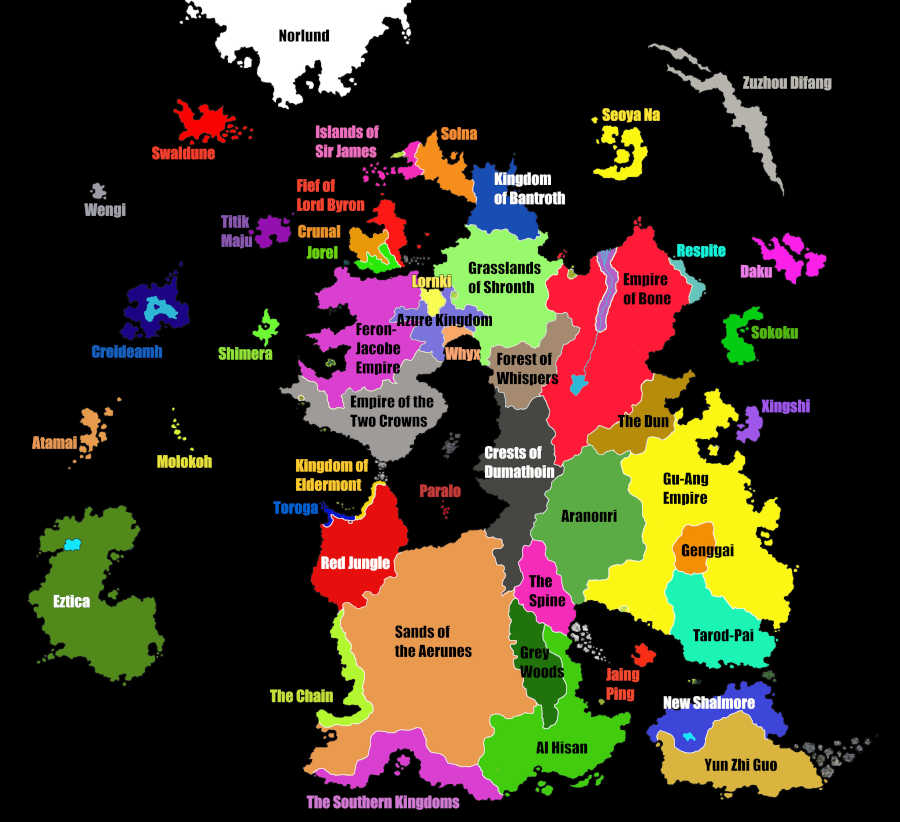
Geography of the World of Kempin with Borders

This version of the map has borders, but is without labels and city names.  It is focused purely on the terrain of the land and the borders between nations and city states.  For those other details, simply choose another map.  Each map on this site highlights different areas of information.  For the most part, this map also excludes rivers.  The scale here is so large that the rivers would be very thin and difficult to see.  River systems will be shown more clearly on maps focusing in on specific areas of the map.

I kept the color and texture pallet here fairly intuitive, as much as possible.  If it looks like green grassy fields...that's what it is, etc.  If you click on the "Zoomed In" link above, a very large version of the map will open for you.  You can then examine the map in much closer detail.

Kempin


Norlund Swaldune Wengai Creideamh Atamai Molokoh Eztica Shimera Titik Maju Islands of Sir James Solna Kingdom of Bantroth Seoya Na Zuzhou Difang Daku Sokoku Xingshi Southern Kingdoms The Chain Paralo Sands of the Aerunes Red Jungle Toroga Kingdom of Eldermont Empire of the Two Crowns Feron-Jacobe Empire Jorel Crunal Fief of Lord Byron Lornki Azure Kingdom Whyx Grasslands of Shronth Forest of Whispers Crests of Dumathoin Aranonri The Spine Grey Woods Al Hisan Jaing Ping New Shalmore Respite Empire of Bone The Dun Genggai Tarod-Pai Gu-Ang Empire Yun Zhi Guo